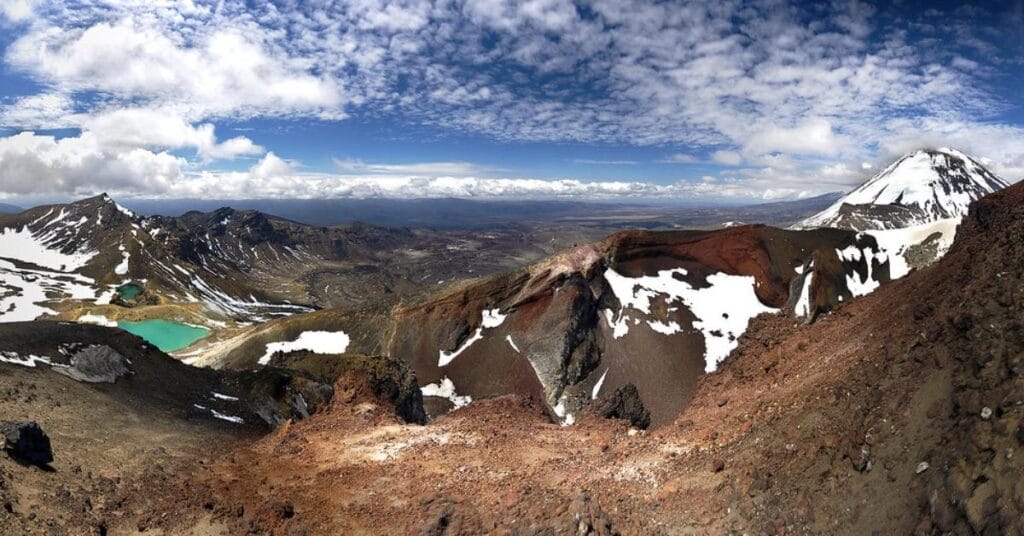
The Tongariro Alpine Crossing hike is widely considered one of the best single-day hikes in the world. Located in New Zealand’s Tongariro National Park, this 19.4 km trail offers dramatic volcanic landscapes, emerald lakes, and breathtaking views that make it a bucket list adventure for hikers around the globe. For those looking to embark on an unforgettable over seas adventure, this comprehensive guide will cover everything you need to know, including the best time to hike, tips for preparing, and what to expect on the trail.
Table of Contents
- What is the Tongariro Alpine Crossing?
- Why You Should Hike the Tongariro Alpine Crossing
- Best Time to Hike Tongariro Alpine Crossing
- Tongariro Alpine Crossing Difficulty Level
- How to Prepare for the Tongariro Alpine Crossing
- What to Pack for the Hike
- Trail Overview: What to Expect at Each Stage
- Safety Tips for Hiking the Tongariro Alpine Crossing
- FAQs About the Tongariro Alpine Crossing
1. What is the Tongariro Alpine Crossing?
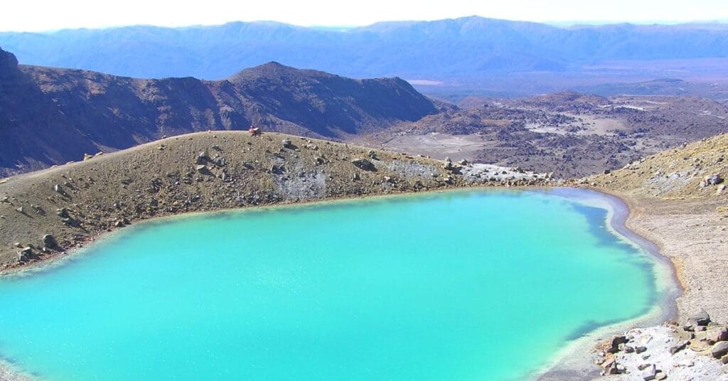
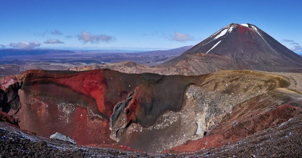
The Tongariro Alpine Crossing hike is a 19.4 km (12 miles) one-way trail in New Zealand’s North Island. This challenging yet rewarding hike takes you through active volcanic terrain, showcasing the diverse and striking landscapes of the Tongariro National Park. Along the way, you will pass by volcanic craters, colorful geothermal lakes, and sweeping views of Mount Ngauruhoe (famously known as Mount Doom from The Lord of the Rings).
This hike is not only a natural wonder but also a culturally significant area to the local Māori people, adding a rich historical element to the journey.
2. Why You Should Hike the Tongariro Alpine Crossing
The Tongariro Alpine Crossing is renowned for offering one of the most unique hiking experiences in the world. Here’s why it should be on your list:
- Diverse Landscapes: From volcanic craters to emerald lakes, the variety of landscapes is unlike any other.
- Challenge and Reward: The hike is physically demanding but incredibly rewarding with panoramic views at multiple points.
- Cultural Significance: You’ll be walking through a UNESCO World Heritage Site, both for its natural beauty and Māori cultural importance.
Whether you’re an experienced hiker or an adventurous traveler, the Tongariro Alpine Crossing provides a once-in-a-lifetime hiking experience.
3. Best Time to Hike Tongariro Alpine Crossing
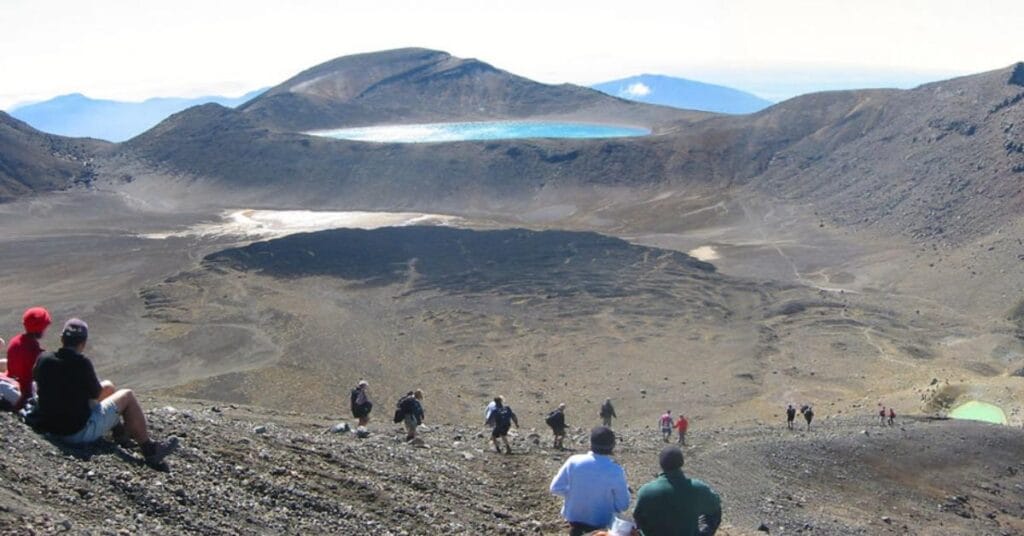
The best time to hike the Tongariro Alpine Crossing is from November to April, which is New Zealand’s summer season. During these months, the weather is generally more stable, with warmer temperatures and less risk of snow and ice on the trail.
While the trail is accessible year-round, winter hikes (May through October) require alpine skills and specialized equipment due to snow and icy conditions. If you plan to hike during the winter months, it’s highly recommended to go with a professional guide.
Peak Season and Crowds
Summer (December to February) sees the highest number of hikers, with up to 3,000 people on the trail per day. To avoid the largest crowds, consider hiking in the shoulder seasons (November and April) or start your hike early in the morning.
4. Tongariro Alpine Crossing Difficulty Level
The Tongariro Alpine Crossing difficulty is considered moderate to difficult, primarily due to the steep ascents and unpredictable weather conditions. Here’s a breakdown of the challenge:
- Distance: 19.4 km (12 miles) one-way
- Elevation Gain: 800 meters (2,624 feet)
- Time: Most hikers complete the trail in 6-8 hours.
Key Challenges
- Red Crater Ascent: This steep section is one of the most challenging parts of the hike. The terrain is loose, and you may need to take your time climbing up.
- Variable Weather: The alpine environment means weather can change rapidly, with strong winds and sudden temperature drops.
Despite these challenges, hikers with moderate fitness levels can complete the crossing with proper preparation and pacing.
5. How to Prepare for the Tongariro Alpine Crossing
Preparing for the Tongariro Alpine Crossing is essential to ensure a safe and enjoyable experience. Here are the key steps to prepare:
- Build Your Fitness: Practice walking long distances on varied terrain. Include both uphill and downhill walks in your routine to simulate the trail’s challenges.
- Check the Weather: Always check the forecast before you start. The weather in Tongariro National Park is notoriously unpredictable.
- Start Early: Aim to start your hike by 7 AM. This gives you enough time to complete the hike during daylight hours and avoids the biggest crowds.
6. What to Pack for the Hike

Packing the right gear is crucial for a safe and comfortable hike. Here’s a basic packing list:
- Footwear: Sturdy hiking boots with good ankle support.
- Layers: The weather can change rapidly, so pack thermal layers, a waterproof jacket, and a hat.
- Food and Water: Bring at least 2-3 liters of water and enough food for the 6-8 hour trek.
- Sun Protection: Sunscreen, sunglasses, and a hat are essential due to the lack of shade on the trail.
- Emergency Kit: Include a first aid kit, map, and a charged phone for emergencies.
7. Trail Overview: What to Expect at Each Stage
Stage 1: Mangatepopo Car Park to Soda Springs
- Distance: 4.8 km
- Time: 1-1.5 hours
- This section is relatively easy, with a gradual ascent through the volcanic terrain.
Stage 2: Soda Springs to South Crater
- Distance: 2 km
- Time: 1 hour
- The terrain becomes steeper, and you’ll start the challenging ascent toward the South Crater.
Stage 3: South Crater to Red Crater
- Distance: 2 km
- Time: 1 hour
- This is the hardest part of the hike, with loose gravel and a steep ascent. The views of the Red Crater are worth the effort.
Stage 4: Red Crater to Emerald Lakes
- Distance: 1 km
- Time: 30 minutes
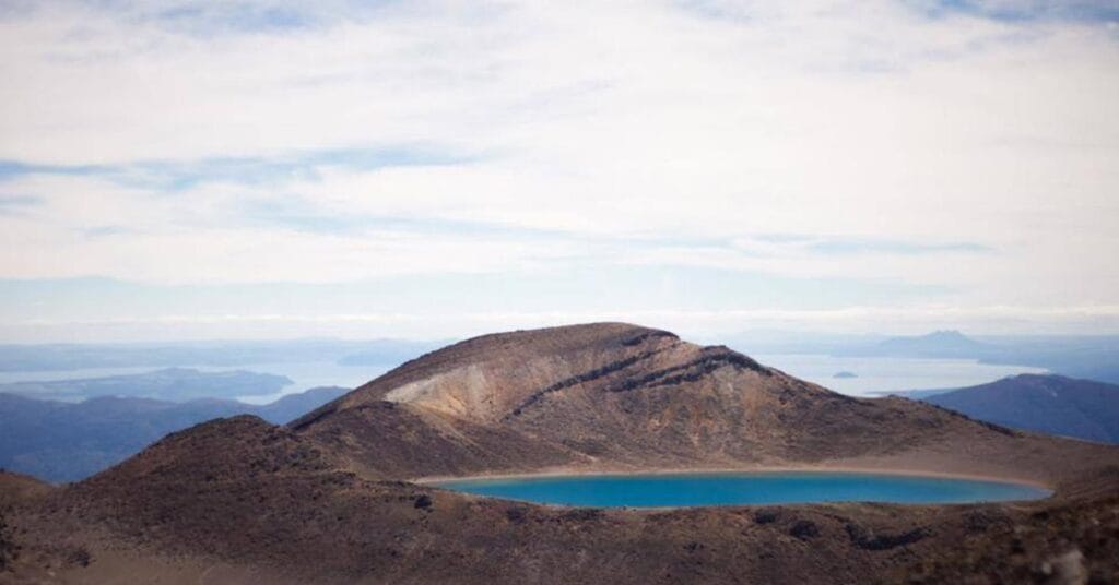
- After reaching the highest point of the trail, you’ll descend to the stunning Emerald Lakes.
Stage 5: Emerald Lakes to Ketetahi Car Park
- Distance: 9 km
- Time: 3-4 hours
- The final stretch is mostly downhill, but it can be tiring after a long day. The terrain becomes more gradual as you approach the Ketetahi Car Park.
8. Safety Tips for Hiking the Tongariro Alpine Crossing
- Know Your Limits: If you’re not sure about your fitness level, consider doing some training hikes first.
- Monitor the Weather: If the forecast looks risky, it’s better to postpone the hike.
- Stay on the Trail: Follow the marked path and avoid geothermal areas, as they can be hazardous.
- Go with a Guide: In winter, or if you’re unsure about the route, hire a guide for safety.
9. FAQs About the Tongariro Alpine Crossing
Q: How long does it take to complete the hike? A: Most hikers take between 6-8 hours to complete the trail.
Q: Is there accommodation nearby? A: Yes, towns like Turangi and Taupo offer a range of accommodation options close to the trailhead.
Q: Can children do the hike? A: The hike is suitable for older children (10+ years) with good fitness levels, but younger children might find it too challenging.


